Mono Lake and the Tufa

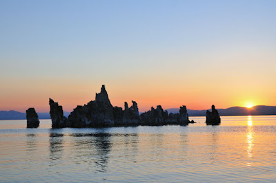
sunrise at Mono Lake

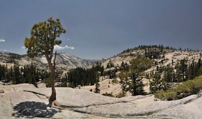
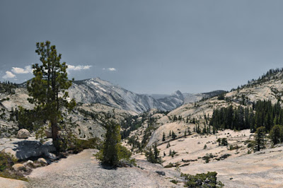
It has been a long standing ambition to see the Tufa at Mono Lake. Finally I have realised this ambition. To get there I drove on the 120 through Yosemite and over the Tioga pass. What a drive! If you are in any kind of hurry, then so be it, but make sure you stop at Olmsted Point.

After booking in at the Gateway motel (map here) I went about 8 miles south on US 395 and then turned left (east) on the 120. About 3 or 4 miles and past Panum crater (very new volcano at about 600 years old) you see the left turn to South Tufa.

Drive on the rough un-tarmac'd road to the car park and pay your $3, then walk on the trail to the shore.

The chemistry of Mono Lake comes from the fact that there is no outlet for the water. If the water level goes down it means evaporation is greater than the inflow. If it goes up then the inflow is greater. During the at ice age the water level was hundreds of feet higher. So like the Dead Sea the water contains a very high level of dissolved minerals, estimated at about 10% by volume.


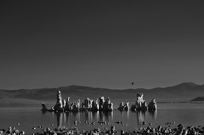
The Tufa are formed by the the interaction of fresh water and the lake water. There is fresh water running off from the Sierras to the West, and it passes through the porous ground to the bedrock below. It continues downhill until it is under the lake where its bubbles up.

I went back for sunset, but was not blessed with great light. So I got up at 4.45 for sunrise at 5.15 ish. The light wasn't great overall, but for a few minutes there was a nice luminance.

Water diversions started in 1941 when the lake had a level of 6,417 feet and by 1982 the lake has lost 31% of its surface area and was at 6,372 feet. Among other environmental effects were the loss of bird breeding grounds and alkali heavy dust storms, which cannot have been pleasant for the local population. An order was passed in 1994 to allow the water level to recover by reducing the diversions. The water level is rather cyclical as you can see from the graph.


The tarmac path stops at the agreed target level of 6392 feet, which is 10 feet or so above today's level. This means many (all?) of the tufa I took photos of will be submerged again, though there will be others near what will be the new shoreline.

Some people have bathed in the lake and have reported the water as having a 'soapy' feel.
I would not bathe in it.With its hypersalinity (about 3x the world's seas) and high alkalinity (pH=10), the 'water' is basically sodium hydroxide and the soapy feel is the alkali turning the fat in your skin into soap.

Yosemite - Olmsted Point

From San Francisco, Yosemite and Momo Lake

Driving through Yosemite on the 120 on the way to Mono Lake, I happened upon Olmsted Point. Up to them I'd ever heard of it. Surely its one of Yosemite's best kept secrets.

The picture taken above is from just a few moments walk from the turn out. You can see down the vale all the way to Half Dome, and if you have a telescope you can see the climbers holding onto the cables going up Half Dome. They really do look like ants!


If you don't mind walking a little further, in fact only another 5 minutes, you get the view below. Surely worth it!

Mount Diablo


From San Francisco...

Mount Diablo State Park is about 40 miles each of San Francisco. The highest point, Mount Diablo itself, is 3,849 feet high and can be seen from much of the Bay Area. There's a road to the top and you have to pay the $6 entrance fee.

From the top you get panoramic views. There is a myth that it has the second highest viewshed in the world, but thats a clearly bogus claim, in fact it was started by a property entrepreneur. It does have one of biggest viewsheds in the US. On a clear day it is possible to see Half Dome in Yosemite at about 125 miles away.

Curiously Mt Diablo is not the highest point in the Diablo Range. That honor goes to San Benito Mount at 5,241 ft .

Mt Diablo's geology is also interesting. This is its entry on the subject in Wikipedia:

"Mt. Diablo is a double pyramid and some say that it resembles a volcano (but is not). [It] is the result of geologic compression and uplift caused by the movements of the earth's plates. The mountain lies between converging earthquake faults and continues to grow slowly. While the principal faults in the region are of the slip-strike type, a significant thrust fault (with no surface trace) is found on the mountain's southwest flank. The uplift and subsequent weathering and erosion have exposed ancient oceanic Jurassic and Cretaceous age rocks that now form the summit. The mountain grows from three to five milimeters each year."

Rheinfalls in Switzerland

From Rheinfalls

The largest waterfall in Continental Europe, the Rheinfalls are 23m in height, 150m wide, and were formed 14,000 to 17,000 years ago during the last ice age.

In the winter the average water flow is 250m³/s, while in the summer, the average water flow is 600 m³/s. The lowest recorded flow is 95m³/s and the highest 1250m³/s.


By comparison the largest in Europe is Gulfoss in Iceland, which in two stages (11m and 21m) falls 32m, with an average of 140 m³/s water in the summertime and 80m³/s in the wintertime. The highest flood measured was 2000 m³/s during a glacial burst.

A day out there is another great value excursion from Zurich (remember Uetliberg). A family of 4 was less than CHF70.-. To get there on the train from Zurich, you need to go to Winterthur and change to the train to Schloss Laufen (not Schaffhausen). It will take about 1 hour. You can go to Schaffhausen, but you have to get a bus, while Schloss Laufen is right by the falls.


map

View Larger Map


From Rheinfalls

Once there you can explore the area, take a boat ride right up to the water, or get the red boat and climb to the top of the middle of the falls. There are the usual selection of local amenities.

According to world-waterfalls.com, the Rheinfalls are the 23rd largest by volume of water, the largest being the Livingstone Falls on the Congo at about 35,000
m³/s. It could be argues that the Inga Falls are greater by volume, but you could also argue that they are really rapids with no actual waterfall.

Robin Hood

Nice to see the nice fellow in green out and about.


Umm thats Robin Hood from Nottingham not the Hulk!