
Its a bit of an effort to see Kelso Dunes, regardless of where you live or are staying. You see them from miles away, and as they are in the class of object that is so big you cannot tell how big they are, their apparent size doesn't really change much, even walking on them.
They rise 600 feet above the desert floor, and are a similar height to the Eureka dunes of The Death Valley National Park and the Great Sand Dunes of Colorado, and the third highest in the US.
 Kelso Dunes are created by a prevailing wind which starts in the southeast and swirls around to the north before becoming a north westerly, blowing and depositing finely grained residual sand from the Mojave River Sink, which lies to the northeast. Next time I'll take a magnet and see if I can try the trick of trawling for magnetite.
Kelso Dunes are in the class of 'singing' or 'booming' dunes. This phenomenon has been known about for thousands of years, with some of the earliest references about "acoustical" dunes being found in Chinese and Mideastern chronicles dating back more than 1500 years.
Marco Polo described hearing weird sounds in the Gobi Desert, and Charles Darwin recorded when he was in Chile.
The sounds have been variously described as singing, whistling, squeaking, roaring and booming, distant kettle drums, artillery fire, thunder, low-flying propeller aircraft, bass violins, pipe organs and humming telegraph wires. Yep thats quite a lot of descriptions!
The low frequency sounds are produced when closely packed sand grains (mostly made of polished grains of rose quartz) slide over each other, such as an avalanche down the slip (leeward) face of a dune.
The stationary sand underneath acts like an amplifier.
 For the movement of the sand to produce sound, the sand has to be very dry. Also the grains are much more rounded and finely polished compared with ordinary (silent) sand.
I took some pictures of the dunes, but what I was most struck by was the still-life qualities of the plants, sand and the shadows they make.
 Waiting for you after the truly great drive on R18 from Los Angeles / San Bernardino area is Lake Arrowhead. When I was there the colors were great.
Do your shopping in the outlet mall, have lunch at Razzbearies Bakery and Cafe - the roast beef sandwich is fantastic, and then take a walk around the shore.
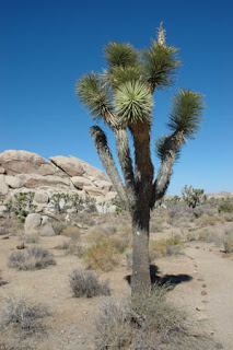
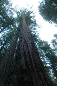
 Its the thing you remember, the trees and the rocks


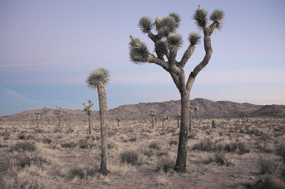
 First Light in Joshua Tree National Park
 Today Joshua Tree National Park is a really dry area, with only the occasional thunderstorm / flash flood. 12,000 years ago it was very different.
Back then we were emerging from the ice age, and the jetstream generally ran much further south than it does now.  The whole area was much wetter with running water and lakes, much like the Pacific north west today.
Gradually the jetstream moved northwards and the area dried up. The  rivers stopped running, and the lakes dried up.
(Salton Sea was dry for thousands of years until due to man's environmental meddling it partially filled with water).
The flash floods have over the years stripped the land of its soil, and left the dusty land we see today.

 The 2 sides of Joshua Tree have different characteristics, the lower hotter east and the higher and slightly cooler west. The Joshua Trees themselves are mostly in the west.
 In the east there are 2 other plants you will see a lot of, the cholla cactus and the ocotilla.
There are a lot of both of these by the side of Pinto Basin Road, in the Cholla Garden and the Octotilla Patch.
Be very c areful with the Chollas, their spines can be really nasty!

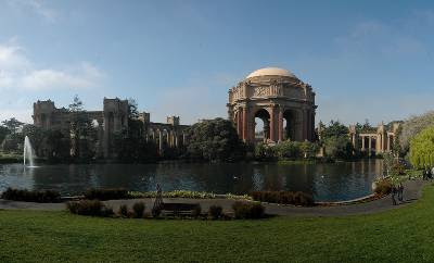
After 4 trips to San Francisco, after the vagueries of (foggy) weather and their landscaping schedule, I finally saw the Palace of Fine Art in San Francisco and its newly landscaped grounds in sunshine. What I really wanted to capture was the Roman rotunda (fantastic color!) against a blue sky. Hurray!
Now owned by the City of San Francisco, the Palace of Fine Arts was built in 1915 for the Panama-Pacific International Exposition on land previously part of the Presidio.
If you are in this part of the world, go see the Longnow Foundation as well. Its only about a mile away at Fort Mason and they've got a great orrery.
 I came across the Longnow Foundation at Fort Mason. Their mission is to change our definition of 'now', believing it is too short a time period, and we should think longer term. They have various projects including a large orrery which has the planets moving in relative scale.
Its an interesting idea. What is 'now'?
'Now' for a volcano such as the Amboy Crater is thousands of years. For a tree 'now' might be the current season, for a muscle cell requiring constant nutrient supply else it dies, 'now' might be fractions of a second.
Maybe the underlying message is that as a society we have gone from change driving us, to us driving change, and being addicted to it. So much of what we do only occurs because of change. A new blog entry else visitors will stop coming, a new range of cars because advertisers don't want to advertise old stuff, and so on.
 Serendipity is my friend.
Before I first saw San Francisco, I never knew it is called Fog City. A friend who lives in the city tells me that until she was 14 she didn't know the sun shone 300+ days a year 20 miles down the road.
Earlier today I was following my nose south of the Presidio and eventually headed up to Twin Peaks. It was one of those foggy / not foggy days, with waves of fog cascading over the hills, and leaving the city (mostly) sunny.
Once, I was on I280 going north through San Bruno. The temperature dropped 10 degrees F in only a mile. Localised weather... love it! 
The world divides into 2: those who drive on the left and those who don't.
Sometimes its is depicted deliberately incorrectly such as in the film 'A Knights Tale'. In the period t was set ie Chaucers time, most likely Knights would have jousted on the left. However the filmmakers show jousting the wrong way round, thinking it would confuse people to show them jousting on the left.
Be that as it may, I noticed the other day that a section of Interstate 5 near has the carriageways reversed in a section about 4 miles north of Castaic.
View Larger Map
 Clouds are one of natures unappreciated wonders.
  Looking down on them is great, watching them cascade towards or away from you, see the fog rolling in.
 When the sun rises and you are above the clouds at 35,000ft, and the conditions are nice, out comes the camera and you can capture some lovely cloudscapes.


